Throughout history, river deltas have played a key role in human settlement and economic development. This can be seen in the towns of the Manning River and its tributaries. Brown’s Creek, historically known as Crooked Creek, is a tidal waterway that flows through Taree skirting the showgrounds into the Manning River Estuary. The creek was the original eastern boundary of the land granted to William Wynter in 1839.1 The once heavily timbered creek banks were home to Aboriginal families with approximately 70 people still living there during 1900.2
The creek has a long industrial history with ties to quarrying, railways and shipbuilding to name a few. One of the earliest industries was the extraction of rich limestone deposits from the banks. In 1856 Messrs Donaldson of Newcastle erected a large freestone kiln and buildings at the entrance of Crooked Creek to create lime, the quality of which was said to be the best and purest.3 The industry grew and in 1904 a jetty was built at the mouth of Brown’s Creek to ship the limestone south.4 Other limestone quarries opened nearby including at Wingham, Chatham and Woolla.
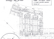
When the railway came to Taree in 1913, it was necessary to supply the steam trains with freshwater. A dam was built adjacent to Brown’s Creek in the now industrial area and an early technique for separating fresh from saltwater was installed. The technique utilised two wooden barriers that slowed the flow of the tide and enabled the freshwater to mostly remain separate from the salt. Remnants of these walls still survive.5
During WW2, boatbuilding in Taree was a critical industry. William Oscar Ryan moved his boatyard from Oxley Island to Brown’s Creek at the end of Albert Street to build and supply small boats to the British and US Armies in 1943/44.6 Haden Bros foundry was granted permissive occupancy in nearby Stevenson Lane enabling them to fit out Ryan’s boats before they were floated out to the Manning River.7 In 2020, The Friends of Browns / Crooked Creek are constructing a boardwalk along the creek which will enable the public to view these industrial remains.
The Manning River continues to play an important role in the regional economy. Careful management will ensure river health is maintained to support ongoing use by our community.
Author: Janine Roberts
Supported by MidCoast Council’s Manning River Estuary Coastal Management Program.


References:
1 NSW Government Gazette, 30 March 1839, Issue No. 403, 369.
2 Manning River Times and Advocate for the Northern Districts of NSW, 9 April 1949, 2; MRT, 9 June 1900, 5.
3 Maitland Mercury and Hunter General Advertiser, 18 October 1856, 2.
4 Grafton Argus and Clarence River Advertiser, 19 September 1904, 2; Daily Telegraph, 12 April 1904, 4.
5 Interview and site visit with Mr Bill Dennis, 17 December 2019.
6 Manning Valley Historical Society, Down to the sea in ships: a history of sea and rivercraft built on the Manning River, Wingham: 2002, 32; Manning River Times, 8 July 1944, 8.
7 Manning River Times, 14 January 1933, 10.