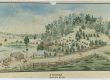
In 1848, as the government strove to formalise unregulated squatting, members of the Denne family applied to lease “Cooplacumpa” (Cooplacurripa). It was described as being 10 square miles in extent.1
Fast forward to the 1880s and Cooplacurripa had expanded to include many former runs: an enormous increase in area.2
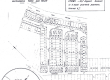
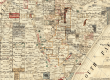
An early, undated, pastoral map shows the holding in the possession of Mackay and Cobb.3 The Mackay family was based at Cangon near Dungog, but had extensive landholdings in NSW. John Kenneth Mackay was at one time in partnership with Alfred Cobb: this partnership was dissolved in 1882.4
The property remained within the Mackay family until purchased in 1950 by Ivan Norrie Livermore.5 He would later recall “A solicitor and myself carried about 350 Deeds … back to where I had arranged my finances”.6 A complex purchase!
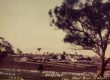
Since Livermore’s death in 2002, the land has passed through various hands. Previously a ring-barked grazing property, a scheme is now registered with the Australian Government Clean Energy Regulator to replant woodland and enhance biodiversity.7
Author: Penny Teerman

References:
1 NSW Government Gazette Monday 14 August 1848 (Issue No. 87) Supplement P1007
2 The Manning Valley Landscape and Settlement 1824-1900, W K Birrell 1987 published by Jacaranda Press
3 NSW Land Registry Services HLRV – Pastoral Name: Cooplacurripa
4 Maitland Mercury Saturday 13 May 1882 P3
5 Manning Valley Historical Society Journal No. 55 (Cooplacurripa Part 1: Early Days, Maurie Garland)
6 The Tales They Tell: a folk history of the Upper Manning, Suzanne Sampson and Margaret Smith 1987
7 Australian Government Clean Energy Regulator: www.cer.gov.au (Silva Capital Biodiversity Project No.1)